Türkiye’s General Directorate of Meteorology has issued an important report on next week’s weather.
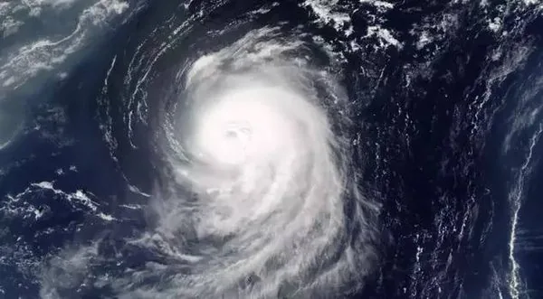
From tonight, Türkiye will be affected by a powerful rainy system known as a “cyclone wave” entering the country from Greece. Heavy rain is expected to begin in Istanbul and Bursa from 03:00 tonight.
Rain warning: Istanbul and coastal cities on alert
According to the latest data, the cyclonic system will show its first effects tonight on the western and southern coasts of the Marmara region. The weather will quickly become unstable, and from 03:00 cities in Marmara — especially Istanbul — will see heavy, continuous rain. The system will intensify from Tuesday morning and spread south, with persistent heavy rain also expected on the Aegean and Mediterranean coasts and inland areas.
Because of high humidity and the cyclone’s strong rainfall potential, the risk of flooding and waterlogging in the Marmara, Aegean and Mediterranean regions is very high on Tuesday and Wednesday. In coastal areas, sea transport may be disrupted and sea levels may rise due to strong winds and storms.
Rain continues until the end of the week
The rainy air mass arriving from Greece will not be limited to the west. According to the meteorological service (MGM), the cyclone wave will be active across much of the country during the week, bringing intermittent heavy rain, and will continue until the end of the week before moving east.
Weather in Istanbul, İzmir and Ankara
With the cyclone arriving from Greece, conditions in Istanbul and İzmir will deteriorate quickly from tonight (Monday night into Tuesday) and last until the end of the week. Istanbul will be among the first and hardest-hit areas, and because of heavy, continuous rain the risk of widespread flooding on Tuesday and Wednesday is very high. İzmir and the whole Aegean coast will also be at the centre of the system, with warnings issued for torrential rain, strong winds and storms; maximum caution is advised.
In Ankara, inland, the system’s effects will be felt later and less intensely. Rain will affect the capital too, but the flood risk is not as high as in Istanbul and İzmir. Residents should still prepare for a cold, rainy week.
People should take the weather warnings seriously to avoid loss of life and property. Key advice:
- Move belongings and objects away from riverbeds and basements to safe places
- Park cars on high, safe ground to prevent flood damage
- Beware of hazards from strong winds, such as falling trees, poles or roofs being torn off
- Avoid unnecessary trips during rain and drive carefully
Five-day weather report for Türkiye
Monday 6 October 2025: partly cloudy and mostly sunny. Temperatures above 25°C in the west and south and around 20°C inland and in the east. Only scattered showers on the Aegean coast. Night and morning temperatures around 10°C, promising cool mornings.
Tuesday 7 October 2025: rain moves from the west towards central areas and intensifies slightly. Thunderstorms and heavy rain are expected in the Aegean, inland Mediterranean, western Central Anatolia and southern Marmara. Coasts still around 25°C, but temperatures drop noticeably inland with the rain. Eastern and south-eastern Anatolia remain partly cloudy with little rain.
Wednesday 8 October 2025: forecast to be one of the wettest days of the week. The rain system covers much of Türkiye, with heavy rain continuing in Marmara, the Aegean, Central Anatolia, western and central Black Sea and parts of the Mediterranean. In the western Black Sea, temperatures fall to around 18–20°C and it feels noticeably cooler. South-eastern and eastern Anatolia will be mostly partly cloudy.
Thursday 9 October 2025: rain eases in intensity and extent, but cool, cloudy weather continues nationwide. Rain mainly on the Black Sea coast, eastern Central Anatolia, inland Mediterranean and the south-east. In Marmara and the Aegean, partly cloudy with temperatures around 20°C — a clear drop from the start of the week.